Map
Photo gallery

Hiking – Climbing
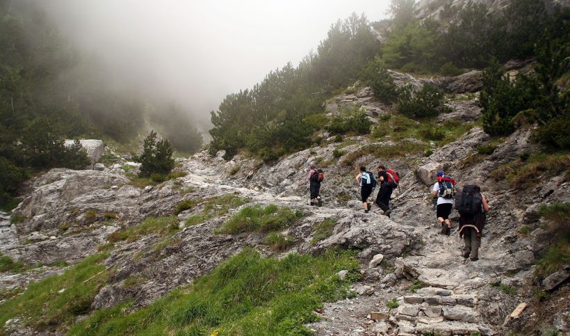
The irresistible hidden landscapes of Kalavryta and the wider region, in combination with the wild beauty of the area will tempt you with a magical way to either in walking or climbing. Kalavryta have all kinds of roots, from easy climbs to pleasant and difficult climbing routes that will fascinate you.
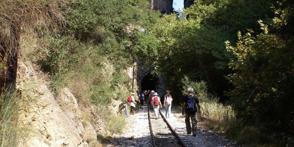
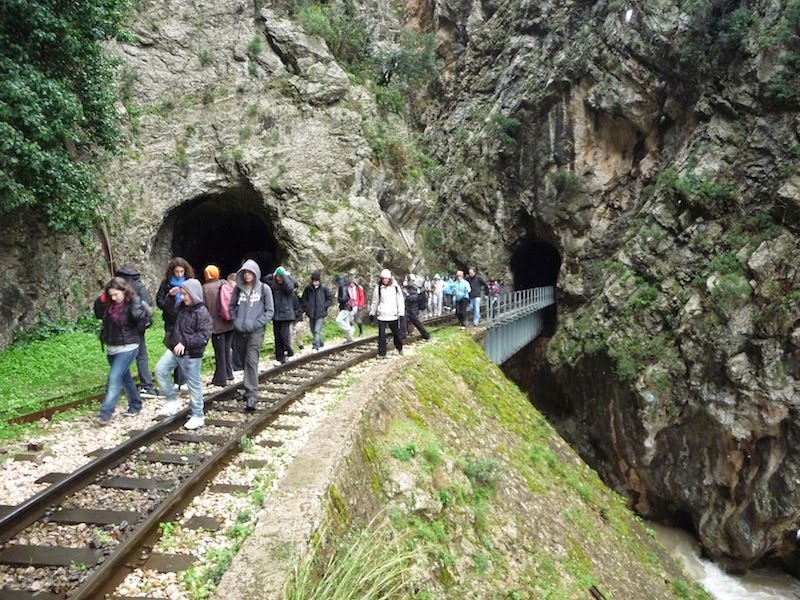
With the proper equipment and in a good moon you can start your day with either the route Kalentzi – Prophet Elias – Evrymanthos either by the extremely beautiful route Alepochori – Katarraktis – Archangels Monastery. One of the great hiking trails, which is worth trying for its variety of natural wealth, is the canyon of the river Vouraikos, which is end in Kalavryta and passes through the village of Zachlorou.
In milder and less rough forest paths you can make your dream come true and try the sport of mountain biking. Equip with a suitable bike and feel the speed in the natural richness of fir trees and towering trees.
The sound of little animals will accompany you during the trip and the rough terrain of the forest will make you love Kalavryta.
ROOT: Ski Center – Mountain Refuge – Neraidoraxi – High Top Mavrolimni – Waters of Styga
ALTITUDE: Refuge 2100m.- Neraidoraxi 2341m.
DIFFICULTY: Difficult root
DURATION: 7 hours
DESCRIPTION: The shortest way to High Top is through the Ski Centre. Following the Vathia Lakka in about half hour from the Ski Center you are in the position of the Pouliou Vrisi, where the retreat of shelter. One hour climb from the refuge and you reach the top of Neraidorahi. Leaving Neraidorahi you pass by Neraidalono and you go straight forward to Aetorahi and High Top. Continue downwards to Mavrolimni and the Waters of Styga.
ROOT: Kato Lousoi – High Top – Kato Kampos –Kefalovriso – Elatofito – Planetary (Ε4)
ALTITUDE: Kato Lousoi 1.000m.- High Top 2.318m.
DIFFICULTY: Moderate root
DURATION: 9 hours
DESCRIPTION: An ascent starts from the village of Kato Lousia. In the begging you follow the road, and very quickly you will enter the pine forest and without having a specific path you will arrive three hours later at the shelter or little on your right you will reach the top in five hours.
ROOT Ε4: ΔDiakofto – Zachlorou – Kalavryta – Kato Lousoi – Planetary (Ε4)- Armpounas –Agios Nikolaos – Tourlada – Krinofita – Lykouria
ALTITUDE: Kalavryta 750m.
DIFFICULTY: Moderate root
DURATION: 2 days
DESCRIPTION: From Diakopto follow the E4 walking alongside the funicular rack railway linking Diakofto-Kalavryta. The scenery is beautiful as it unfolds in the valley and steep Vouraikos Gorge. You first arrive at the station of Klavryta and then you continue to Helmos. As you walking you will reach the chapel of Agios Nicholaos. You will pass over the Ano Lousoi, and then you will climb up and reach the Kato Lousoi where there is plenty of water fountains and a cafe. From the small village square follow the road left, cross the bridge and continue until you reach the church on the edge of the village. Then following the left side of the road you will arrive to a deep ravine Lagada. Stay on the right side until you find the dirt road that goes into a ravine. Turning left and follow the track until you reach a drinker (an hour and a quarter). From here you change direction and descend directly into the streambed. Cross over and begin to climb on the left side in the south-southeast direction. Soon you meet dirt road and after half an hour you will arrive at Planitero. Since you continue to village Arbounas. Just before this village you will find huge planes and a spring. Across the way from Arbounas to Tourlada our right down the valley Aroanio with all crops, homes and villages. Leaving the village take the road to Klitoria to the west. Before starting the turns near a chapel, turn south and take the path to Krinofyta. At the square of Krinofita you chimp up to Likouria.
ROOT: Peristera (Solos)- Water of Styga
ALTITUDE: Peristera 1.000m.
DIFFICULTY: Moderate root
DURATION: 3,5 hours
DESCRIPTION: The most impressive root is through the Peristera village (or Solos). Spot of great beauty is lake Tsivlou (700m.) surrounding by forest, a few kilometeres from Persistera. You begin by forest road that leads into a forest of pines and continue on a path to a spot of great views (two and a half hours). After half an hour walking you will be at the base of the waterfall of Styga Waters.
ROOT: Springs Ladona – Pagkratio – Klima Pafsania
ALTITUDE: Pagkratio 860m.
DIFFICULTY: Moderate root
DURATION: 2 hours
DESCRIPTION: From the sources of the Ladon get marked trail, passes through a water mill and begin to climb until an hour we reached the village Pankration (850m.). One hour west is the historic vine of Pausanias, whose age is estimated at 2,000 years. We recommend you visit the historic vine.
ROOT: Skepasto – Panagia Plataniotissa – Makellarias Monastery
ALTITUDE: Skepasto 1.100m.- Plataniotissa 2.318m.
DIFFICULTY: Moderate root
DURATION: 7 hours
DESCRIPTION: Starting from Skepasto climping up to the top until the Valta village. Then you follow the road to Panagia Plataniotissa and going west to Makellaria Monastery.